Southbound: The Alaska Highway and the Canadian Rockies
For our return trip from Alaska we decided to take the official Alaska Highway, some 1400 miles from Delta Junction, AK to Dawson Creek, BC then back to the US by way of Alberta and into Montana, to check out the Canadian Rockies. All together it would end up being 2,400 miles. Since this was going to be such a long drive we decided to break the trip up with a few stopovers to do some hiking, and ended up taking almost two weeks.
Our first stop was at Kluane National Park outside of Haines Junction, Yukon . Taking advice from some people we met at a campground we made an unplanned stop that turned out to be a pretty good one. Kluane National Park borders Wrangell St Elias on the Canadian side and combined with Katmai National Park creates one of the largest protected areas in the world. We stopped by their very thorough and knowledgable visitor's center to get some info on the hiking in the area and then set up camp at the park for the night.

Kluane National Park camping
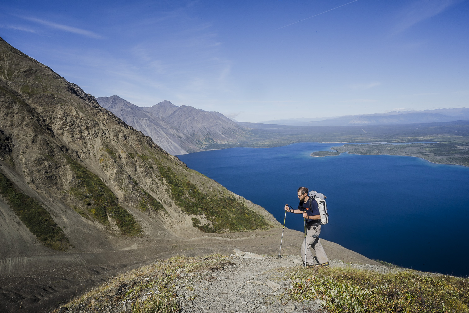
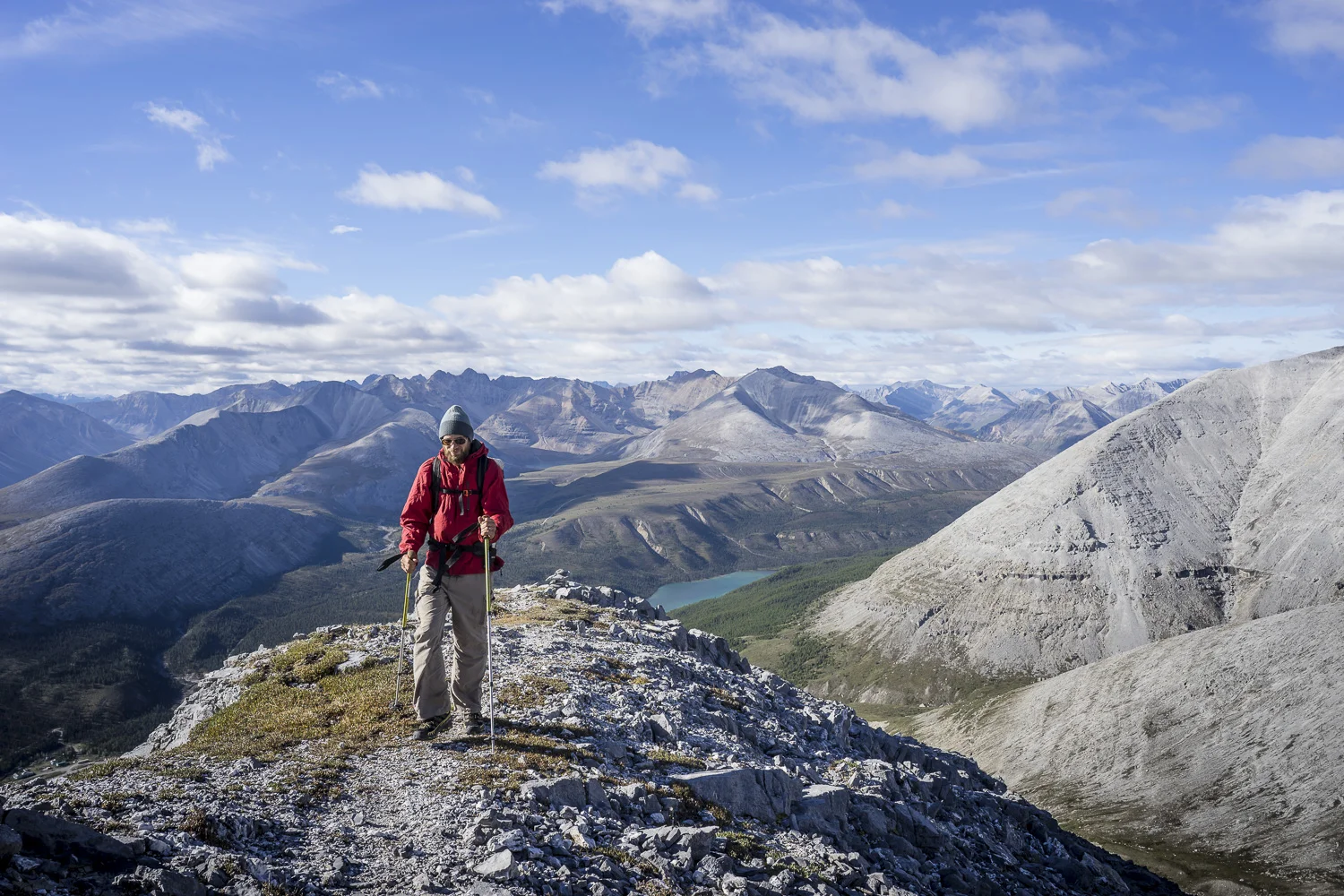
Many of the hikes in this park require commitments to substantial elevation gain and time for backpacking. Not feeling up to several days in the backcountry we opted one of the front-country treks called King’s Throne which climbs to a shelf below the summit; an un-official path continues up a steep shoulder to the summit ridge. This was a steep hike with several options that all provide good views of Kathleen Lake. We went for the middle of the road option and hiked part way up the ridge past King’s Throne but stopped short of the summit all told it was 7.6 miles roundtrip with around 3,000 feet of elevation.

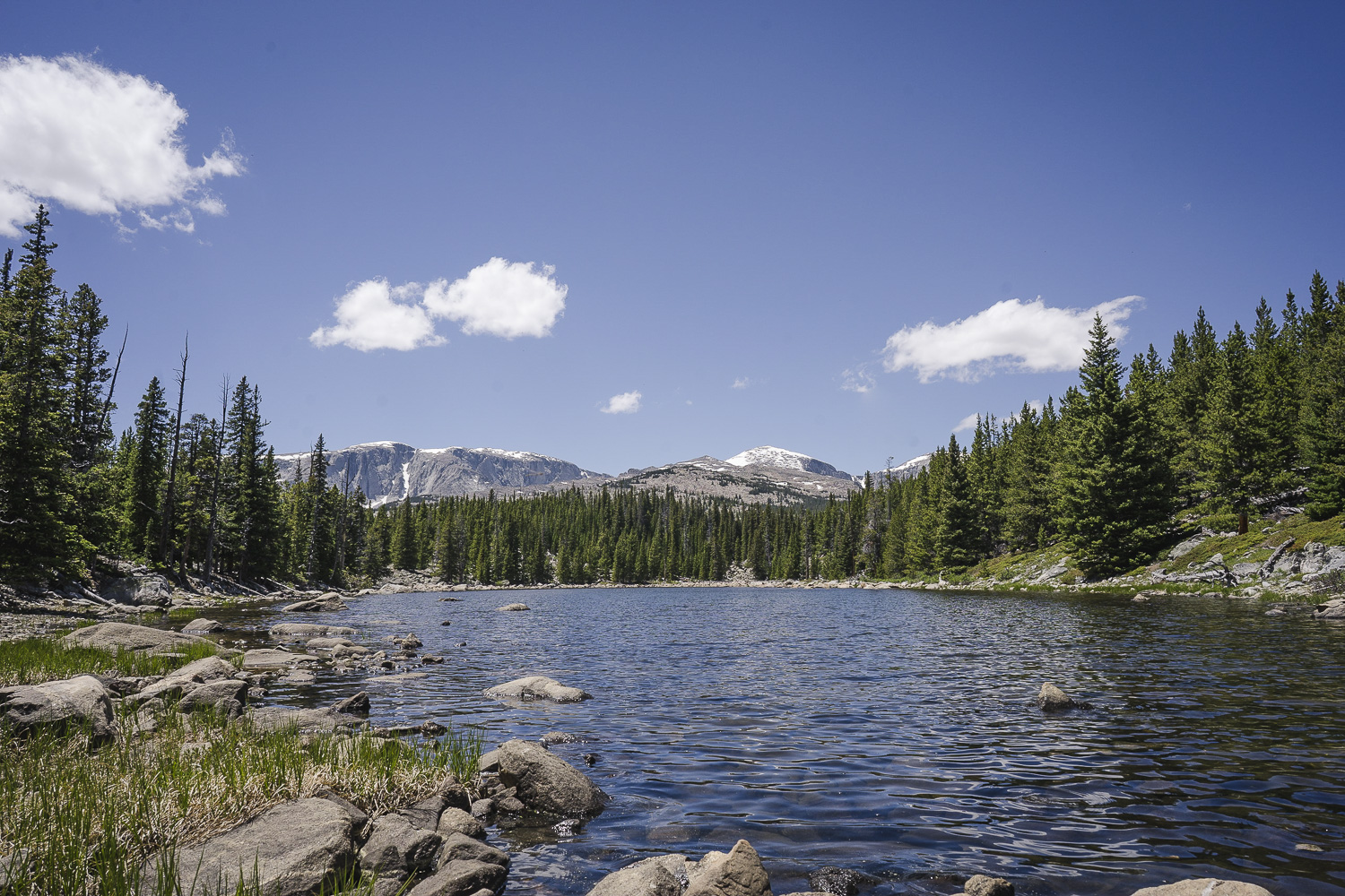
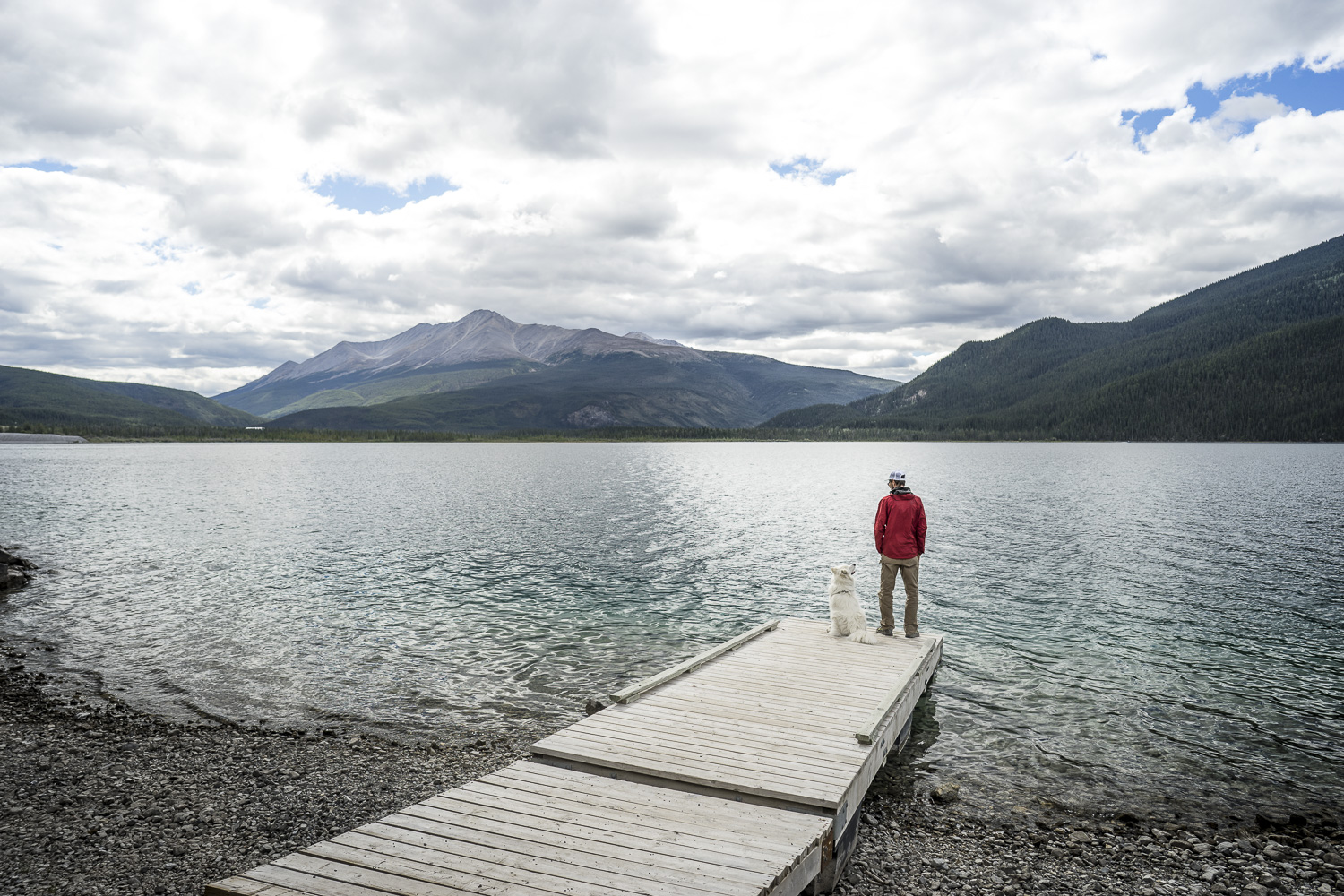
Kathleen Lake Kluane National Park, Yukon

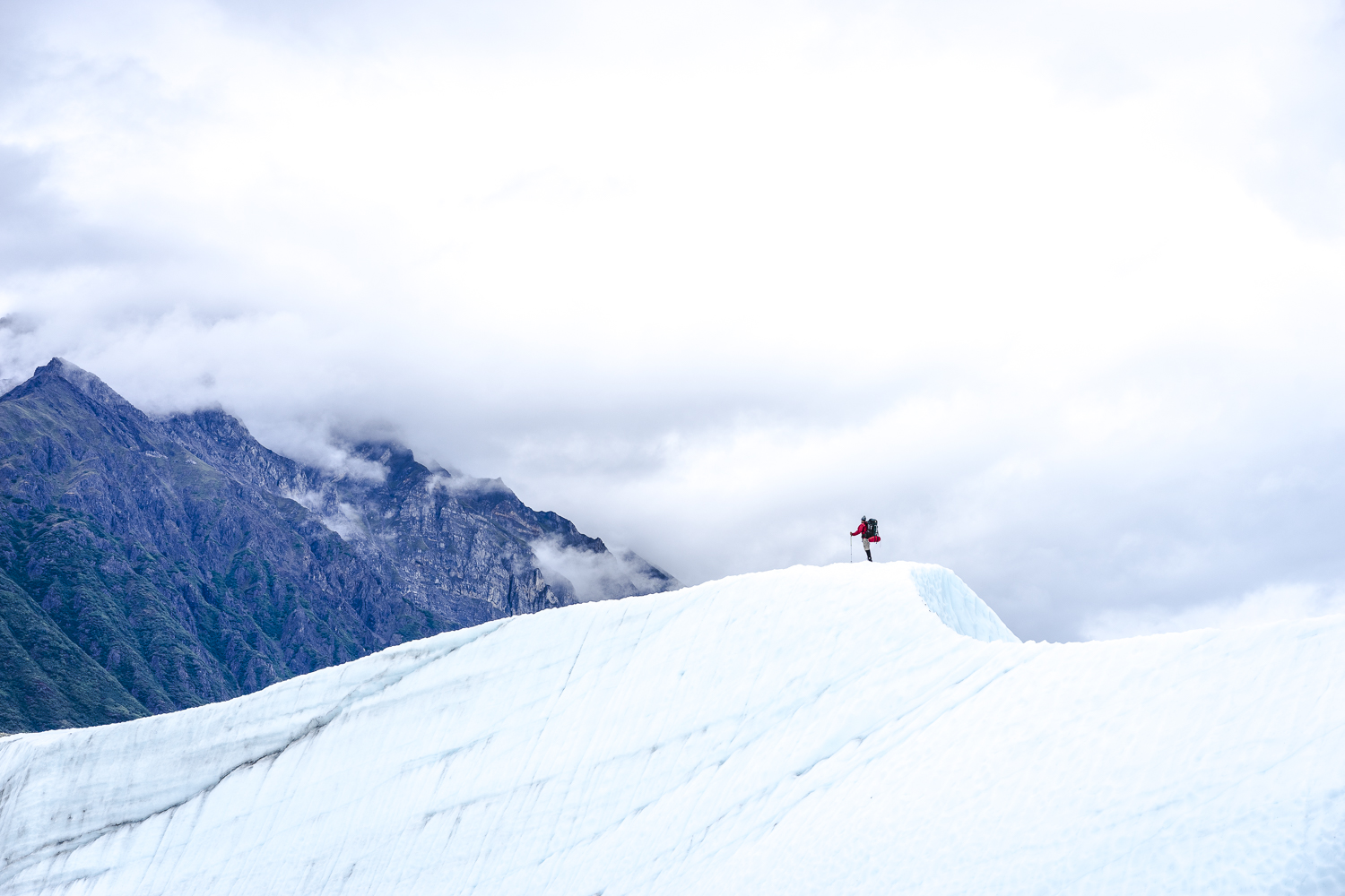
Steep hike up King's Throne, but great views! Kluane National Park
The next stopover was in the Northern Rockies in British Columbia at Summit Lake located north of Fort Nelson, BC. The campground adjacent to the trailhead made this an ideal place to stop for a couple of days. The hike here was Stone Mountain and Summit Lake Lookout. We opted to just do the Summit Lake Lookout portion of the hike; this one much like the hike in Kluane was steep right from the beginning. At the lookout point you are afforded views of Summit Lake and the surrounding Northern Canadian Rockies. This one was just under two miles one way and a little over 2,300 feet of elevation, rather steep and open- definitely not a hike to do in bad weather.

Quick stop at Muncho Lake: Northern Rockies, British Columbia
Summit Lake Hike:


After passing through Jasper and Banff, unfortunately on a weekend, we quickly headed toward the Kananaskis area to get away from the hordes of tourists further north. Peter Lougheed Provincial Park was a place we had targeted prior to the trip for just that reason; it’s far enough off the beaten path that you do not get the traffic of the Banff area and the scenery is just as good if not better. There are several campgrounds in the area and really none are any better than the other with the exception of the Interlakes Campground. Positioned right on Lower Kananaskis Lake it seemed to be the only campground that offered waterfront sites. On one of our rest days we were out exploring and just happened to snag one of the best sites possibly in the entire park right on the water.


Campsite views: Peter Lougheed Provincial Park, Alberta

We picked two hikes to do in in this area. The first was toRawson/Sarrail Ridge overlooking the stunning Upper Kananaskis Lake. This one checked in at three and a half miles one way with around 3,000 feet of elevation. The trail started as a moderate uphill with many hikers stopping at the end of the official trail at Rawson Lake. An unofficial pathcontinues from Rawson Lake to the ridge and it is steep and definitely a workout.
Rawson Lake/Sarrail Ridge Hike:


The next hike we picked was the Pocaterro Ridge that was to offer views of the surrounding mountains and lakes. This one didn’t necessarily go according to plan; it was an unmarked trail with several different meandering paths. At one point we managed to take the wrong path and ended up in the Grizzly Col area instead of the ridge we had intended to climb. Although we did not get where we wanted to that day the scenery did not disappoint. Given easy access to trails, spectacular scenery and camping Kananaskis is a great alternative to the more crowed options in the area.
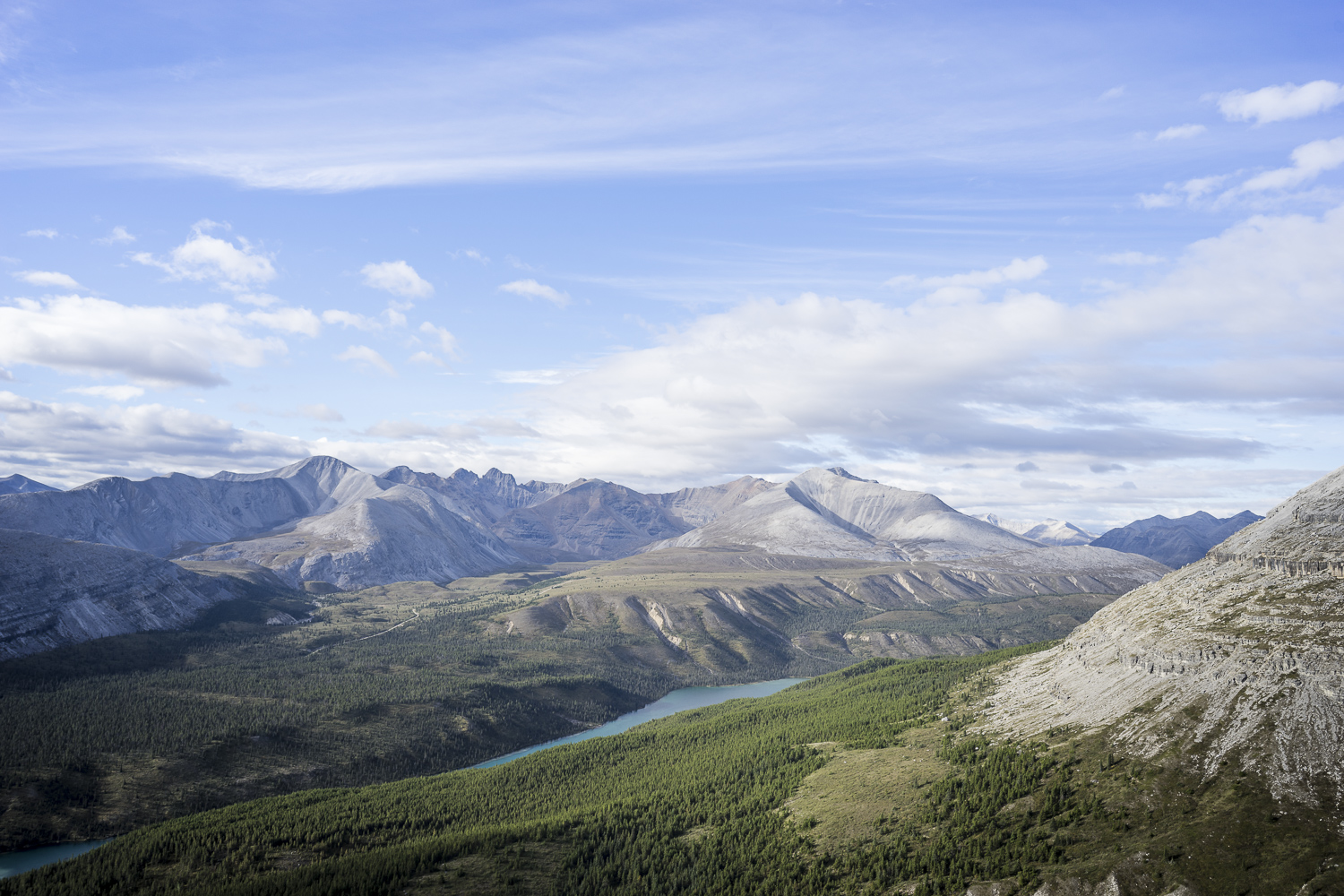
Grizzly Col Hike:


Having driven two of the major access routes to Alaska, the traditional Alaskan Highway (The Alcan) and the westerly access route from Vancouver, BC piecing together the Sea to Sky, Yellowhead and Cassair Highways, we can say that the westerly route offers a little more in the scenery department. The traditional route passes through some nice mountain scenery in the Canadian Rocies but is broken up by large stretches up developed areas and crosses through a currently booming oil field district.
Info:
Resources/Maps: Kluane Visitors Center provides all necessary maps and descriptions, Kananaskis Where the Locals Hike, local hiking maps downloaded on Gia GPS app for iPhone, Milepost-The Alaskan Highway Guide
Entrance Fees: Kluane- Free, Banff/Jasper -$20/day, Peter Lougheed- Free (All prices are Canadian)
Camping: Kluane, YT -$16/Various Yukon government camps-$12 (includes firewood!) Summit Lake, BC-$20, Peter Lougheed-$26, Saskatoon Lake, AB-Snaring River Jasper-$16 (All prices are Canadian)
Pets: Pets are welcome in Kluane and Peter Lougheed, they are not so welcome in Banff/Jasper with many trails being closed to dogs due to protected Wood Caribou habitat
Tips: Don’t run out of beer it is extremely expensive, think $40+ cases of beer!!